Cycling and Walking in and around East Grinstead
Official cycling and walking routes in and around East Grinstead
- Worth Way – 7 mile mixed use route https://www.westsussex.gov.uk/leisure-recreation-and-community/walking-horse-riding-and-cycling/worth-way/
- Forest Way – 10 mile mixed use route https://www.eastsussex.gov.uk/leisure-tourism/countryside-sites/forest-way-country-park
- Avenue Verte – 247 miles of cycling route between London and Paris https://www.avenuevertelondonparis.co.uk/
- Route 21 – 95 mile cycling route – London to Eastbourne https://www.sustrans.org.uk/find-a-route-on-the-national-cycle-network/route-21/
- Vanguard Way – 66 mile walking route – Croydon to Newhaven https://www.vanguardway.org.uk/
- Sussex Border Path – 159 mile route – Thorney Island to Rye https://www.sussexborderpath.co.uk/
- Highweald Landscape Trail – 95 mile route – Horsham to Rye https://highweald.org/things-to-do/high-weald-landscape-trail/
- William Robinson Gravetye Walk – 3 mile or 1.7 mile william-robinson.org.uk/visit-us
- Greenwich Meridian Trail – Sussex section (Book 1) 47.5 mile route Peacehaven to East Grinstead. There is a commemorative plaque in the paving at East Court (RH19 3LT) in front of the building, not far from the Millennium Stone.
Public rights of way
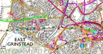
A map showing public rights of way around East Grinstead is available here.
A Public Rights of Way interactive map is also available from the West Sussex County County web site.
The right of way network for the East Grinstead area can be found on Ordnance Survey Explorer Map No. 135 Ashdown Forest.

